Space4Nature (S4N) - A model for open research in biodiversity conservation
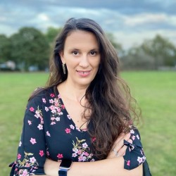
Dr Ana Andries, Research Fellow in CES, with S4N team, have been embedding the principles of Open Research, by using Open Access VHR satellite data and citizen science to promote transparency, accessibility, and collaboration for habitat mapping and biodiversity conservation.

Introduction
Space4Nature (S4N) is a groundbreaking three-year collaborative project aimed at addressing critical biodiversity challenges in Surrey County, UK. Funded by the PPL Dream Fund and conducted by the University of Surrey in partnership with Surrey Wildlife Trust, Buglife, and the Painshill Park Trust, the project utilises advanced technologies, including very high-resolution (VHR) satellite data and citizen science, to create predictive habitat maps and assess habitat quality. S4N aligns with Open Research objectives by enhancing accessibility, transparency, and reproducibility in scientific endeavours.
Research context
S4N focuses on habitat restoration through the establishment of Nature Recovery Networks (NRN), leveraging VHR satellite data (Planet Scope, 3m resolution), citizen-collected ground truth data, and machine learning techniques. The project emphasises collaboration with ecologists and citizens to validate results and contribute to transparent research processes.
In terms of open practices, S4N embraces open and participatory methods by involving citizen scientists in ground-truthing surveys. This engagement not only enhances transparency but also widens participation in research. Open peer review is implemented by ecologists from partner organisations (SWT and Buglife) in the validation process, ensuring a collaborative and transparent approach to certification. In addition, historical surveys spanning over two decades are integrated openly into machine learning models, promoting the reproducibility and transparency of research processes.
The methodology can be accessed through two ways, GitHub for codes and ESRI ArcGIS Pro workflow, (illustrating the tools used, presented in ESRI Story Maps), catering to a diverse audience with varying skills and software access. Later, the project results will be shared alongside methodologies openly on the Land App platform (under a well-established IP), contributing to the accessibility of research outputs.
Challenges and solutions
S4N encounters challenges related to satellite data of VHR accessibility and the diverse skill set required for different tools. VHR satellite data is accessed on Planet Lab that offers 5000 sq. km per month which poses some limitations if the project needs to be reproducible at a national scale. However, Planet Scope has in place affordable licences that offer unlimited 3 m satellite data. In addition, the high cost of ESRI ArcGIS licenses can be addressed by providing alternative open-source solutions through GitHub, ensuring accessibility for researchers with varying financial constraints. The project acknowledges the balance between simplicity (ESRI ArcGIS, which doesn’t require coding skills) and affordability (Python, which requires coding, but is free to use) and strives to cater to a wide range of users.
Benefits realised
The open practices employed by S4N yield significant benefits. The engagement of citizen scientists ensures a dynamic and diverse dataset, contributing to the calibration and validation of the satellite data. Openly sharing methodologies, data sources, and validation processes fosters collaboration and knowledge exchange within the scientific community. The integration of historical datasets into ML models enhances the reproducibility of research, contributing to the broader scientific understanding of habitat mapping.
Lessons learned
The experience gained so far emphasises the importance of balancing accessibility and affordability in Open Research. The project underscores the need for clear communication and training to bridge the gap in skills required for different tools. The iterative process of involving citizens and ecologists in validation has proven to be effective, highlighting the value of collaborative and transparent research practices.
Conclusion
Space4Nature stands as a beacon for Open Research practices in biodiversity conservation. By seamlessly integrating citizen science, machine learning, and historical datasets, the project exemplifies transparency, accessibility, and collaboration. The commitment to open methodologies, data sharing, and validation processes not only advances scientific knowledge in habitat mapping but also sets a precedent for future endeavours in Open Research. The key takeaway from S4N is the transformative power of openness in fostering sustainable land use practices and biodiversity conservation.
Contact details
- Ana Andries, Lecturer in GIS and Remote Sensing, CES, FEPS
- Prof Richard Murphy
- Prof Stephen Morse
References and further information
The source code for supervised classification for chalk grassland and heathland habitat mapping is published on GitHub.
ESRI Story Maps
- Introducing Space4Nature
- Quarry Hangers: a test site
- Citizen Science and Space4Nature
- Space4Nature Techniques (part 1)
- Space4Nature Techniques (part 2) (in progress)
